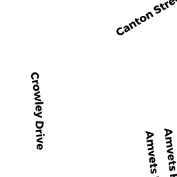
18 CROWLEY DR
Owner Information
ONEAL EDDIE S
18 CROWLEY DRIVE
RANDOLPH, MA 02368


Property Details
18 CROWLEY DR is classified as a Single Family Residential (Raised ranch).
The primary structure on this property was built in 1972. There are 2,524ft2 of built area within this property. There is 1,232ft2 of residential/living space within this property. This property is listed as having 6 rooms.
18 CROWLEY DR is valued at $363,000. The land is valued at $157,800 and the structures are valued at $205,100. There is an additional valuation of $100 on this property.
This property is in Zone RH. Confirm with local Zoning Board authorities to ensure there are no overlays or other easements on this property.
The most recent deed for 18 CROWLEY DR is recorded at the local registrar in Book 13416, Page 0389. 18 CROWLEY DR was last sold on Friday, April 30, 1999 for $185,000.
Assessment data from fiscal year 2022.
Flood Data
According to the FEMA National Flood Hazard Layer, this property does not appear to be in a flood zone. It may also be in an area not yet reviewed. Nonetheless, confirm this information prior to taking any action.
To view the flood hazards around this property, create a FEMA "Firmette" Map of the area around 18 CROWLEY DR.
Broadband Internet Providers
| Provider | Type | Bandwidth (mbps) | |
|---|---|---|---|
| VSAT Systems, LLC. | Satellite | 2 | 1 |
| Verizon New England Inc. | DSL | 5 | 0 |
| Viasat Inc | Satellite | 100 | 3 |
| Comcast | Cable | 1000 | 35 |
| Verizon New England Inc. | Fiber | 940 | 880 |
| GCI Communication Corp. | Satellite | 0 | 0 |
| HughesNet | Satellite | 25 | 3 |
Broadband service provider data from December 2020.
Adjacent Properties
- 7 WM MORRISON DR
Residential Condominium owned by YERMOLENKO DMITRY - 5 WM MORRISON DR
Residential Condominium owned by LAU CHIANG C - 11 WM MORRISON DR
Residential Condominium owned by EGD PROPERTIES TWO LLC - 9 WM MORRISON DR
Residential Condominium owned by EGD PROPERTIES FOUR LLC - 22 CROWLEY DR
Single Family Residential owned by HUYNH DAN D & NANCY N TBE - 14 CROWLEY DR
Single Family Residential owned by DYETTE HUGH & MURIEL TBE